Saturday 19 August 2023

皇朝直省地輿全圖 1889


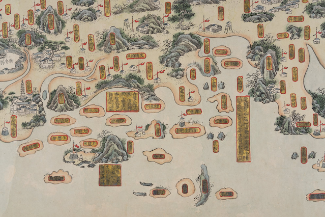
皇朝直省地輿全図 光緒15 23 廣東 香港 急水門 點石齋石印 上海老閘西首 南北申昌


https://www.digital.archives.go.jp/file/1067249


Thursday 10 August 2023

Lei Yue Mun (Lyemun) in historical maps and photos

 DRAFT

  1. 1547-1559 嘉靖24至38 大明輿地圖 廣東輿圖
  2. 1595 粵大記 萬曆本 郭棐 廣東沿海圖 香港 鯉魚門 赤柱 黃泥埇 大潭 稍箕灣
  3. 1581 萬曆9 蒼梧總督軍門志  全廣海圖
  4. 1621 天啟元 武備志 鄭和航海圖 佛堂門 官富寨 大嶼山
  5. 1685 康煕24 《廣東輿圖》  新安 官富山 佛堂門 大奚山 獨鰲洋 合連海 杯渡山
  6. 1688 康熙27 《新安縣志》 南北佛堂 官富山 獨鰲洋 急水門
  7. 1693-1722 康熙末年 皇輿全覽分省圖  大帽山 官富山 急水門 大澳 杯渡
  8. 1708–1718 康熙47至57 康熙皇輿全覽圖 官富山 急水門 杯渡 磨刀 大澳 大帽山
  9. 1730 雍正8 陳倫炯 《海國聞見錄 ‧ 沿海全圖》 1793 (no name)


  1. 清中至晚期 南中國海岸圖卷 Gallica of Bibliothèque nationale de France
  2. 1746-1749 Carl Johan Gethe's Itinerary Book Kept During the Journey to East India, from October 18, 1746 to June 20, 1749Image 212 showing Lantao and Macao


  1. 1760 Carte d'une partie des côtes de la Chine et des îles adjacentes... earliest use of the name Fanchin chow 泛春洲 Hong Kong Maritime Museum 1771 1775 no name 
  2. 1778 A Chart of the China Sea from the Island of Sanciam to Pedrabranca with the course of the river Tigris from Canton to Macao. Po-ke-long Point=Lei Yue Mun Point. 1780 Ref.: Henry D. Talbot's "A British Maritime Chart of 1780 Showing Hong Kong," Journal of the Hong Kong Branch of the Royal Asiatic Society, Vol. 10 (1970), pp. 128-133
  3. Early 19th century 福建廣東海防航海圖 (Fujian Guangdong Coastal Defence Navigation Chart) in Hong Kong Maritime Museum on Google Art and Culture


  1. Daniel Ross_This chart of the different passages leading to Macao Roads 1810 Hong Kong 紅江
  2. 1814 Chart of the coast of China to the eastward of the great Ladrone no name Cow-loon
  3. Post-1815 廣東通省水道圖 no name
  4. 1816-1832 廣東全省經緯地輿圖 no name
  5. 1819 嘉慶24 新安縣志 新安志圖:鯉魚門炮台  卷四:「鷄婆山在九寨東南,怪石嶙峋。昔土冦李萬榮駐此,以掠商舶。」「鯉魚門在官富山南。」


  1. Pre-1820 廣州府新安縣水陸塘汛輿圖 no name 大埔 元朗 屯門
  2. 1822 廣東通志 卷83 新安縣圖
  3. 1831 Chart of Choo Keang or Canton River by James Horsburgh 1833 1847
  4. 1834 Die Chinesische Küste der Provinz Kuang-tung, zu beiden Seiten des Meridians von Macao Ly-i-mun
  5. 1838 廣東海防彙覽
  6. pre-1839 廣東沿海統屬圖 in Hong Kong Maritime Museum on Google Art and Culture

  1. Treaty map 1841 (surveyed by Captain Sir Edward Belcher
  2. MPK 1.148 Hong Kong Surveyed by Captn. Sir Edward Belcher H.M. Surveying Ship Sulphur,1841_1843-1895
  3. PH64.001 Hong Kong Map 1844 Henry Colburn of Marlborough Street, London 26 x 20 cm
  4. MAP000134 The ordnance map of Hong Kong 1845 Southampton]  [Board of Ordnance
  5. 1846 The Lyeemoon from Hong Kong side (Hong Kong. Royal Engineers' Office)
  6. 1846 The Lyeemoon from the Highest Peak Hong Kong (Mount Parker) (Hong Kong. Royal Engineers' Office)
  7. 1846 The Lyemoon from the outside (Hong Kong. Royal Engineers' Office)
  8. 1846 The Lyeemoon from the Chinese side (Hong Kong. Royal Engineers' Office)
  9. HONG KONG &C. AS SEEN FROM THE ANCHORAGE by Lieutenant (later Admiral) Leopold Heath in 1846 and published in 1847. Taken from a vantage point aboard HMS Iris anchored centrally in the harbour they combine to form an overlapping 360 degree panorama of the harbour. Hong Kong--Heath, Leopold G_Hong Kong &c. as seen from the anchorage
  10. The Ordnance Map of Hong Kong by Lieut. Collinson 1846 
  11. Treaty map, Beijing Treaty 1860
  12. 1861 Oostkust van China: van Pingyang Punt tot Macao Lyemoen passage
  13. 1864 廣東全圖 湖北官書局編制 1864 廣東全圖 同治三年 1864 大澳 大帽山 杯渡山 no name
  14. 1866 Map of the San-On District Simeone Volonteri NLA
  15. 1870-1871 廣東圖說 毛鴻賓 桂文燦 萃文堂 同治9-10  新安縣圖


  1. 1879 廣州府志


  1. 1879 Map of the Province of Canton according to the map of the Kwong-Tung tʻu shot 
  2. Digital Commonwealth_Channels to Hong Kong and Macao 1877 Compiled by James F. Imray, F. R. G. S.
  3. 1881 七省沿海全圖 七省沿海圖 (no name)
  4. 1884 Kantō-shō Chōshū-fu yori Renshū-fu ni itaru 自廣東省惠州府博羅縣東至同海豐縣沿道略圖》 香港 九龍塞 油麻地 造船所 沙田
  5. Channel to Hong Kong and Macao 1885
  6. 1887 廣東全省水陸輿圖 (no name)
  7. 1891 清朝柔遠記
  8. 1896 皇朝直省輿地全圖
  9. 1897 廣東輿地全圖
  10. Map attached to The Convention for the Extension of Hong Kong Territory, 1898
  11. 1899 HK MPG 1-796 CO 700 Sketch map showing southern part of Kwangtung Province and Hong Kong
  12. Map of the Hongkong and Lilong mission areas. Dilger, J. 1905 - 1914
  13. Map of the colony of Hong Kong 1907
  14. Map of Hong Kong and New Leased Territory 1911 Chatham
  15. MAP000138 Hong Kong (Sheet 5) War Office 1922 70 x 105 cm
  16. MAP030031 Hong Kong and the New Territories_War Office 1936 74 x 100 cm
  17. Battle progress outline map of fighting for capture of Hong Kong 香港攻略戰戰鬥經過要圖
  18. National Institute for Defense Studies_Battle progress outline drawing of fighting for capture of Kowloon peninsula 九龍半島攻略
  19. Hong Kong, 1948 ANU
  20. Hong Kong Surveyed by Captn. Sir E. Belcher 1843 (Major Corrections to 1953) 2
  21. Hong Kong and the New Territories 1957 ANU
  22. Detailed War Office and Air Ministry Two-Sheet Chart of Hong Kong 1958 2
  23. Hong Kong, Jan Jan's Map of Hong Kong, 1958 ANU
  24. Map of Hong Kong Kowloon and the New Territories 1960 1
  25. Hong Kong, Population Distribution In the Urban Area of Hong Kong, 1967
  26. Hong Kong, The Functional Land Use in the Urban Area of Hong Kong, 1967
  27. Hong Kong, Distribution of Population in Hong Kong, 1967
  28. Hong Kong, Population Density In the Urban Area of Hong Kong, 1967
  29. MAP000121 Hong Kong, Kowloon and the New Territories (Sheet 2) 1974 Crown Lands and Survey Office 100.8 x 76.2 cm

Sunday 6 August 2023

Report on the Riots in Kowloon and Tsuen Wan 九龍及荃灣暴動報告書(1956)

Sources from Diplomatic Archives of the Ministry of Foreign Affairs


1. English full text:

“Miscellaneous Matters of British Colonial Circumstances: Department of Hong Kong: Kowloon and Tsuen Wan Riots (October 1956)/Partition 2” Japan Center for Asian Historical Records (JACAR) Ref.B21010210700, British Colonial Circumstances: Department of Hong Kong: Kowloon and Tsuen Wan Riots (October 1956) (A'.4.3.1.10-1-1) (Diplomatic Archives of the Ministry of Foreign Affairs)

https://www.jacar.archives.go.jp/das/image-en/B21010210700


2. Chinese full text:

“Miscellaneous Matters of British Colonial Circumstances: Department of Hong Kong: Kowloon and Tsuen Wan Riots (October 1956)/Partition 3” Japan Center for Asian Historical Records (JACAR) Ref.B21010210800, British Colonial Circumstances: Department of Hong Kong: Kowloon and Tsuen Wan Riots (October 1956) (A'.4.3.1.10-1-1) (Diplomatic Archives of the Ministry of Foreign Affairs)

https://www.jacar.archives.go.jp/das/image-en/B21010210800


3. Newspaper clippings:

“Miscellaneous Matters of British Colonial Circumstances: Department of Hong Kong: Kowloon and Tsuen Wan Riots (October 1956)/Partition 1” Japan Center for Asian Historical Records (JACAR) Ref.B21010210600, British Colonial Circumstances: Department of Hong Kong: Kowloon and Tsuen Wan Riots (October 1956) (A'.4.3.1.10-1-1) (Diplomatic Archives of the Ministry of Foreign Affairs)

https://www.jacar.archives.go.jp/das/image-en/B21010210600